Day 15—Lanlivery to Land’s End

The final day. Breakfast had been scheduled for 08:00, and I arrived a few minutes early so that I could make a quick getaway; at this point we were all keen on getting to the end. John and Jamie were there, and we were soon joined by Amardeep. Carl and Les were having breakfast in another hotel and would be ferried over at about 08:30 by Rob so that we could all set off together. There was to be no solo stuff from me today; we had planned a triumphant processional ride, like the last stage of the Tour de France, but without the sprint on the Champs-Élysées. With this in mind, it made sense to discover that the slightly slower Cornish contingent, with Mike, had decided to leave a couple of hours early that morning so that we could meet up a few miles from Land’s End. That would explain the bicycle noises I had heard as I woke up!

Me and Amardeep

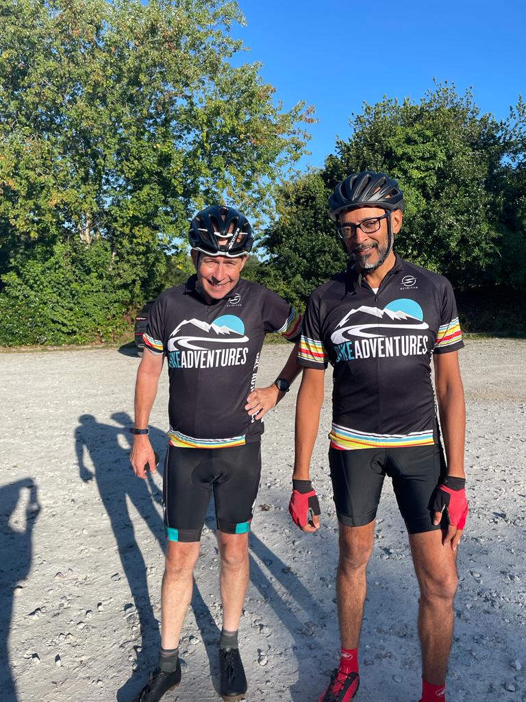
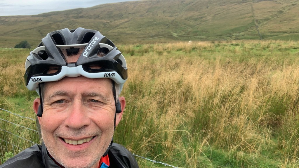
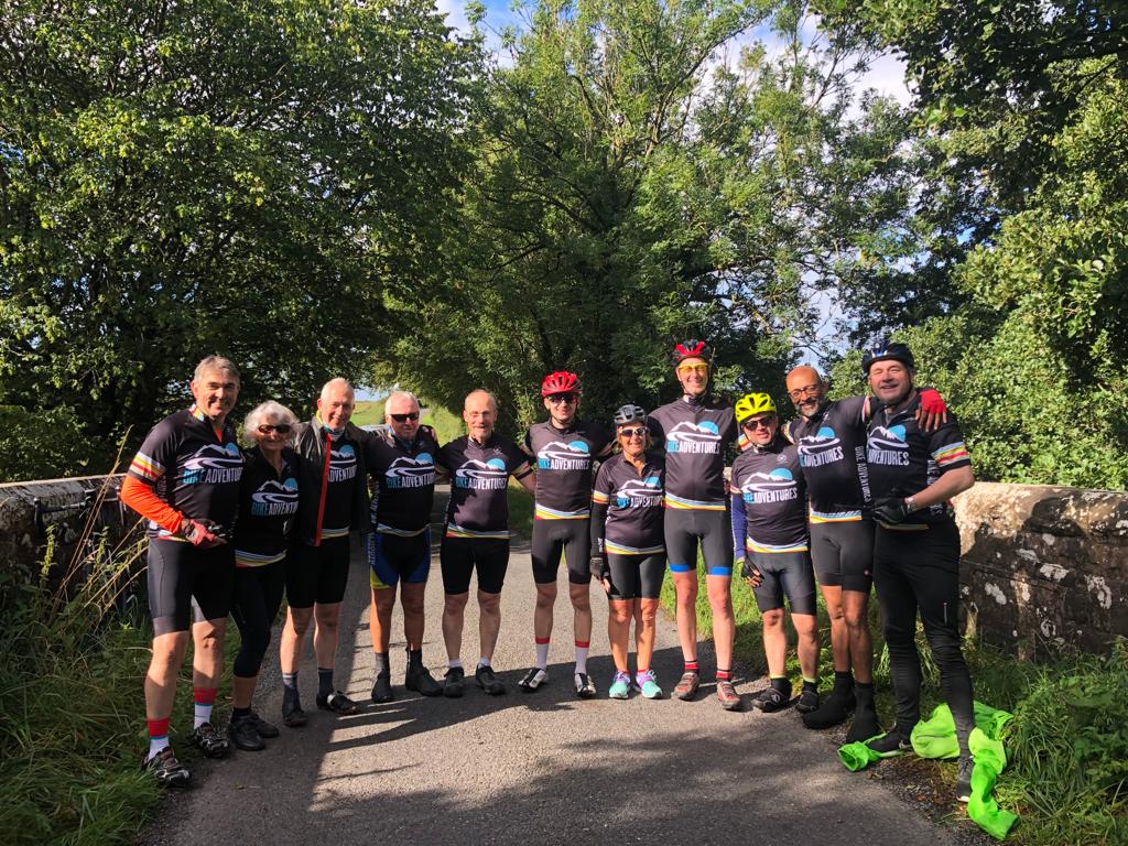
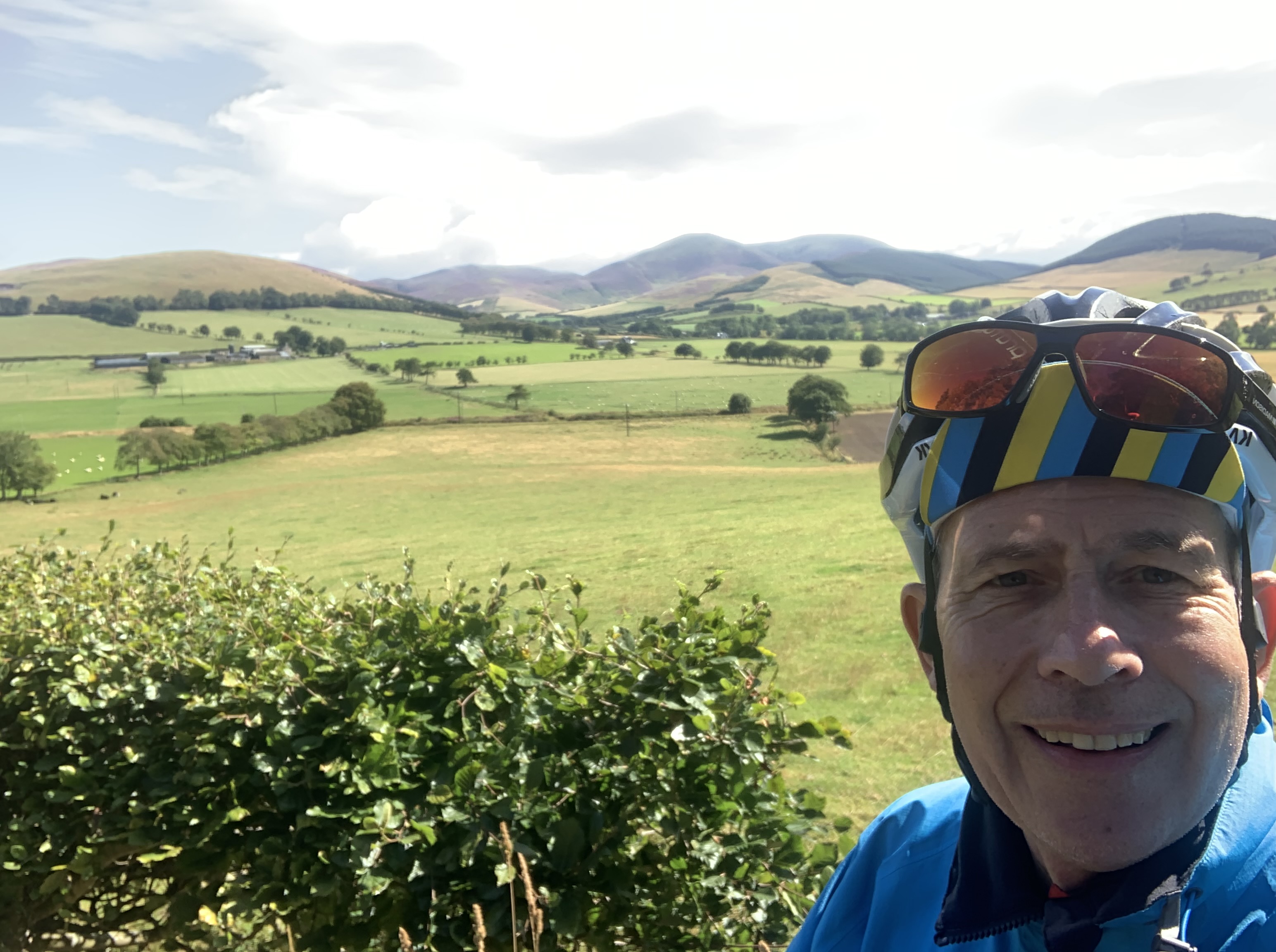
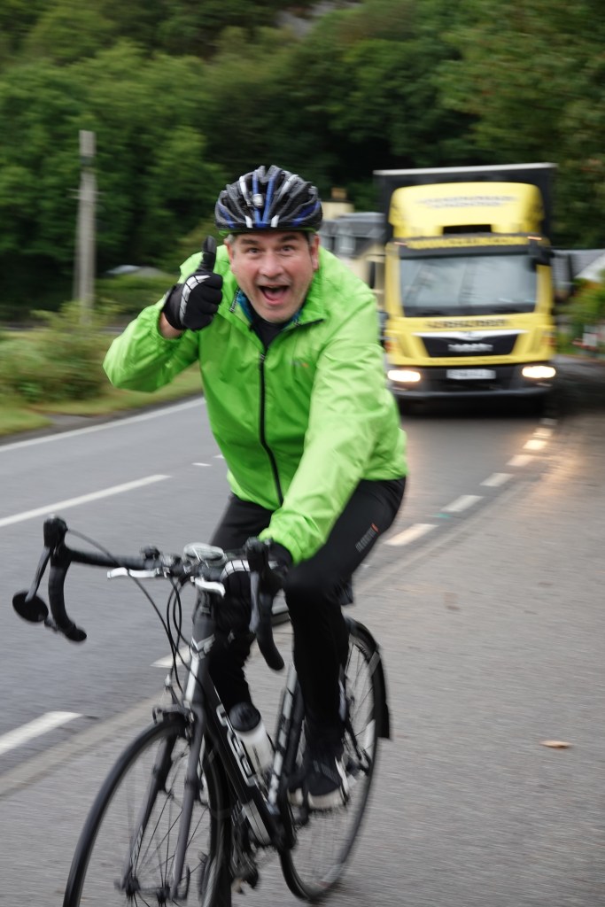
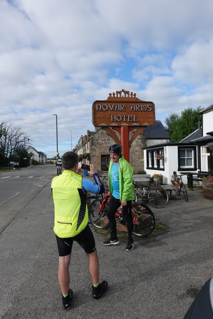
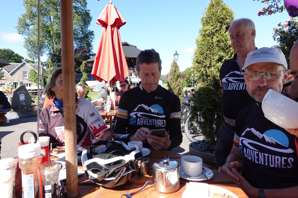
With the exception of John and Jamie, who wore their Honeypot shirts, we were all wearing our Bike Adventures kit. Almost as stylish as Team Ineos Grenadiers, I’m sure you’ll agree. Amardeep and I are modelling the shirts here (right), and I took a selfie of me and my bike as well (below).

Me and my bike, ready to go

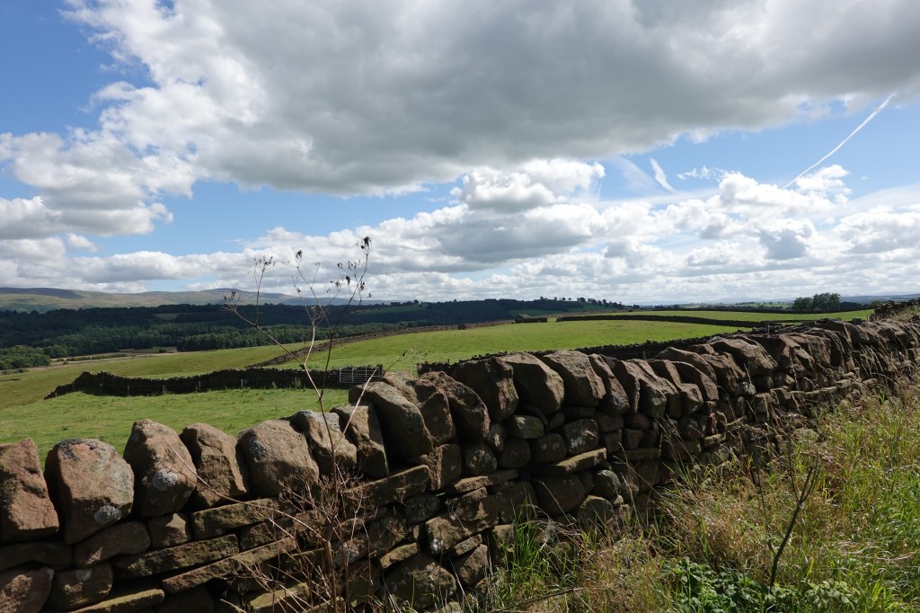
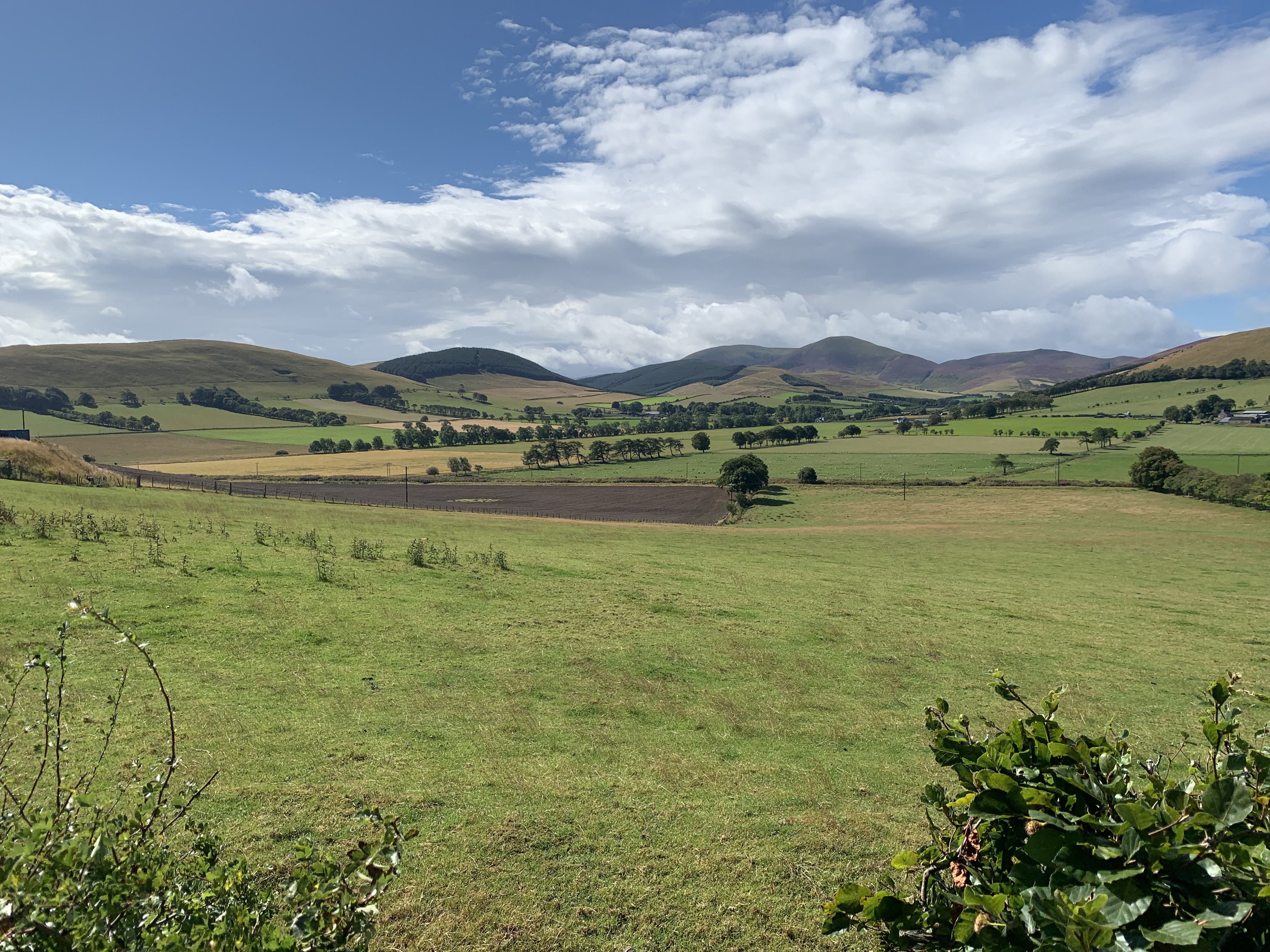
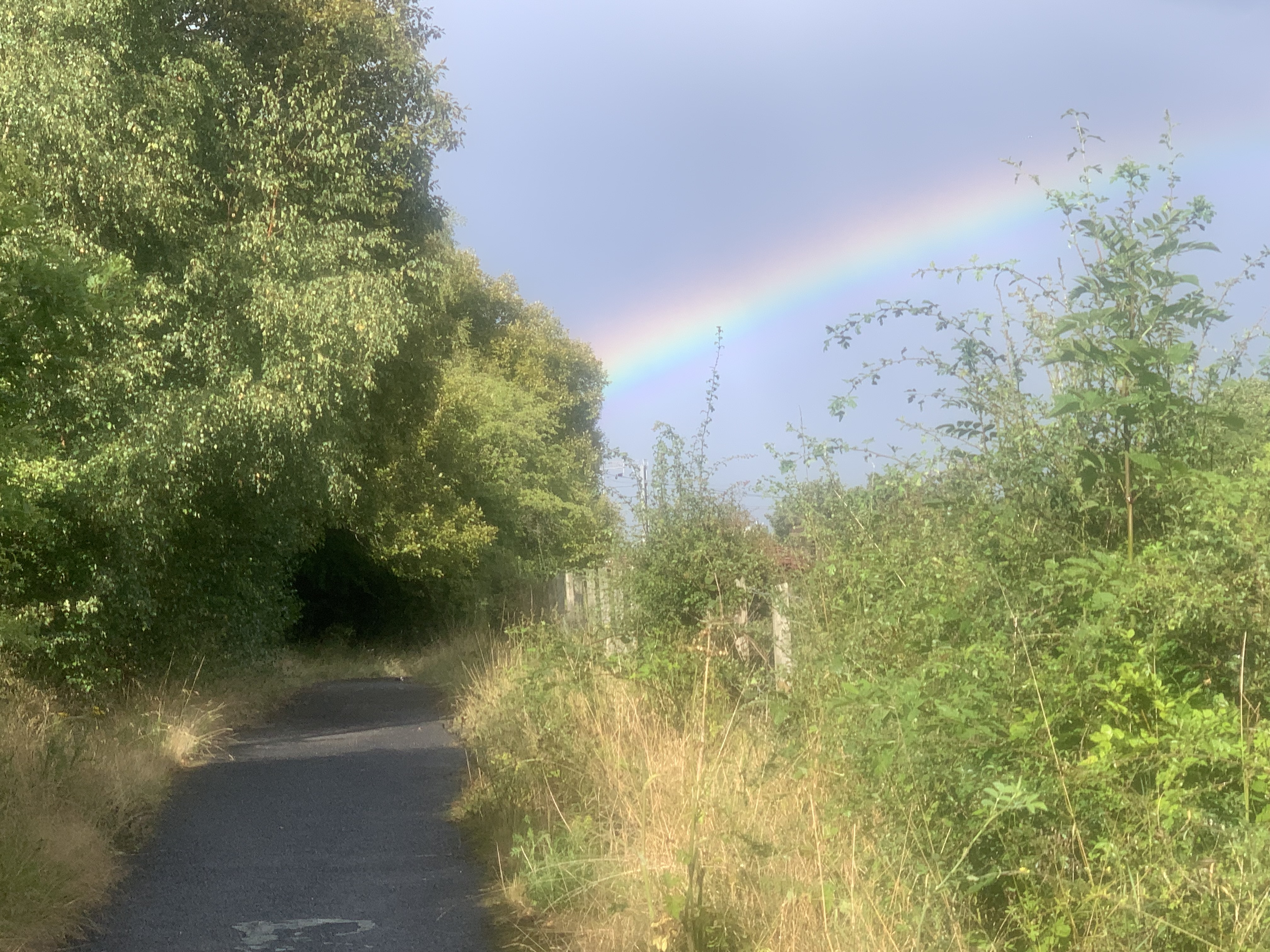
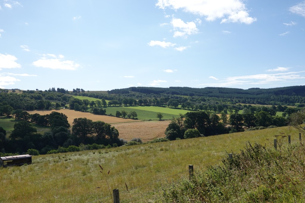
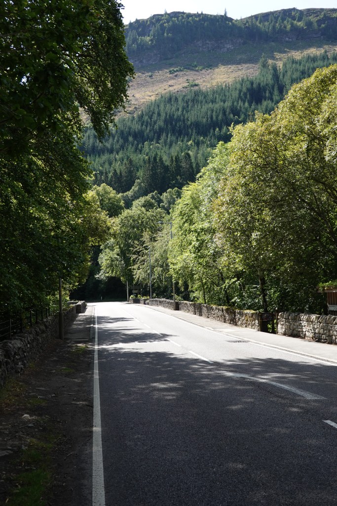
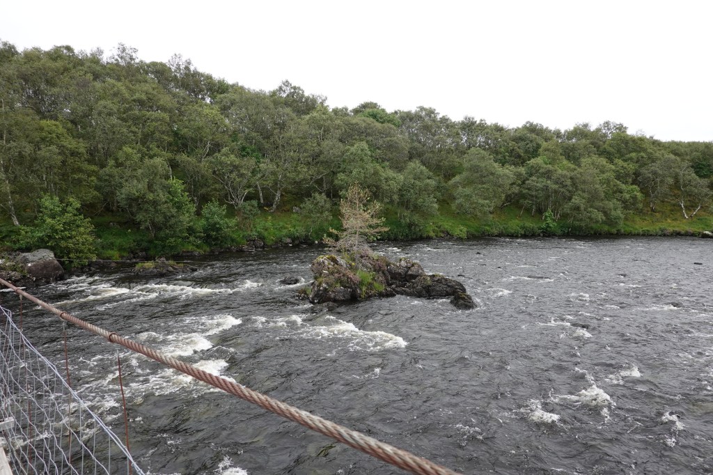
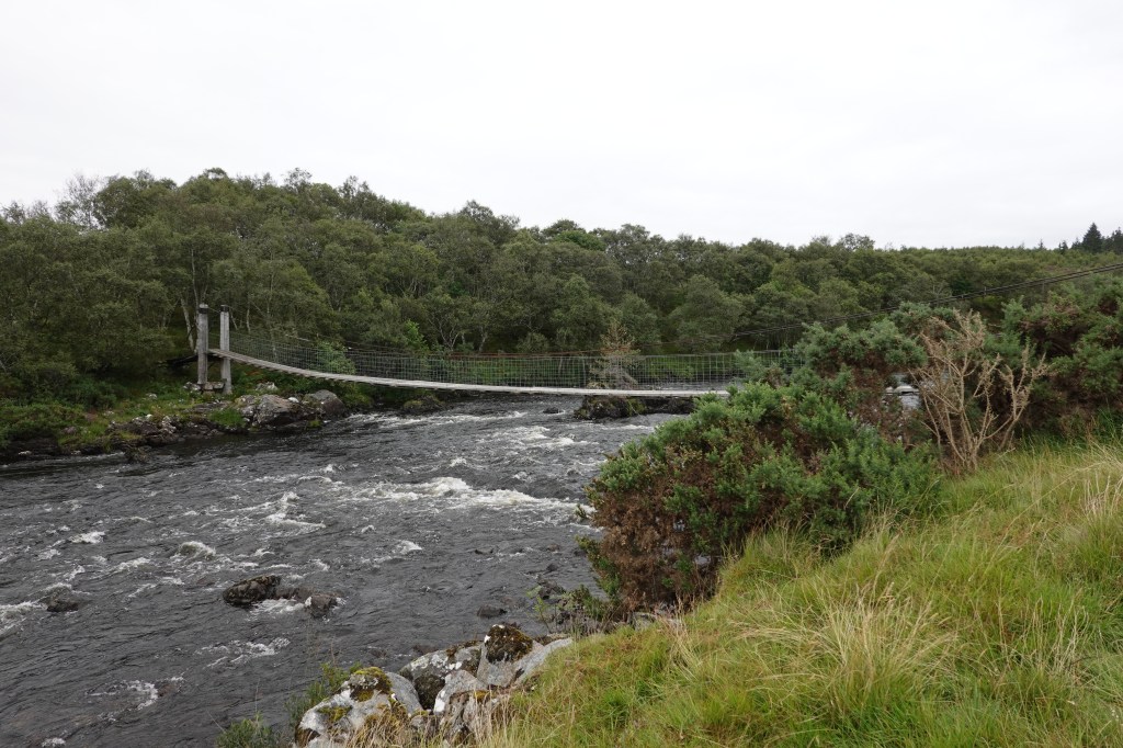
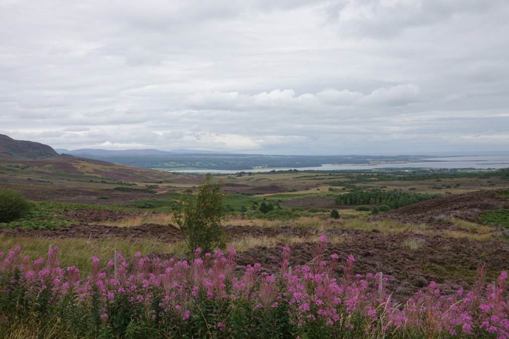
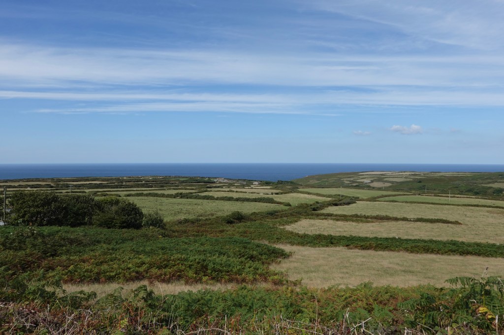
We headed out due West, aiming for the North Cornwall coast. It was what we cyclists call ‘lumpy’. Up and down, up and down. So many rivers to cross.

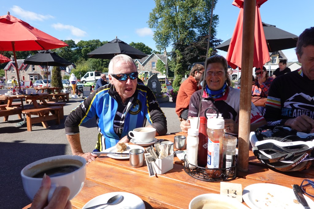
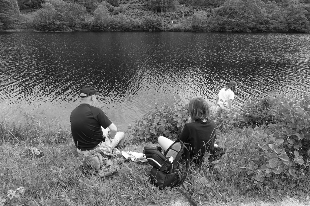
I can’t remember where we stopped for coffee—Perranporth or St Agnes, I think it was. Maybe one of my fellow riders will read this and be able to tell me. All I really remember was that the coffee and cake were OK, but the service was glacial. For a cyclist in a vague hurry, this was hopeless. I did get a chance to fill my bottles, however, and as the day wore on this became increasingly important. It was getting hot, and the thing with cycling is that it’s easy to lose fluid without knowing it. You may be sweating, but it evaporates so quickly you’re hardly aware of it. As Julian Hutchings says—drink before you’re thirsty! Jamie was very good at this. Almost every time I saw him he was swigging from his bidon.

Me with a pasty

Anyway, refreshed, we left our coffee stop. We were setting quite a reasonable pace, and eventually caught the Cornish contingent, who had stopped for a lunch break. We thought of stopping with them, but had resolved to have lunch 46 miles into our ride in Hayle, at the HQ of Philps Pasties. Apart from an inadvertent Ginsters earlier in the ride, this was to be my first and my last pasty, and from the size of it, it could have been my first, my last and my everything. (Note spurious references to popular songs in this part of my writing.) It was huge, and, I must say it was delicious. I think I managed to eat about 70% of it, and if I hadn’t been cycling it would have easily made a nourishing meal for two.

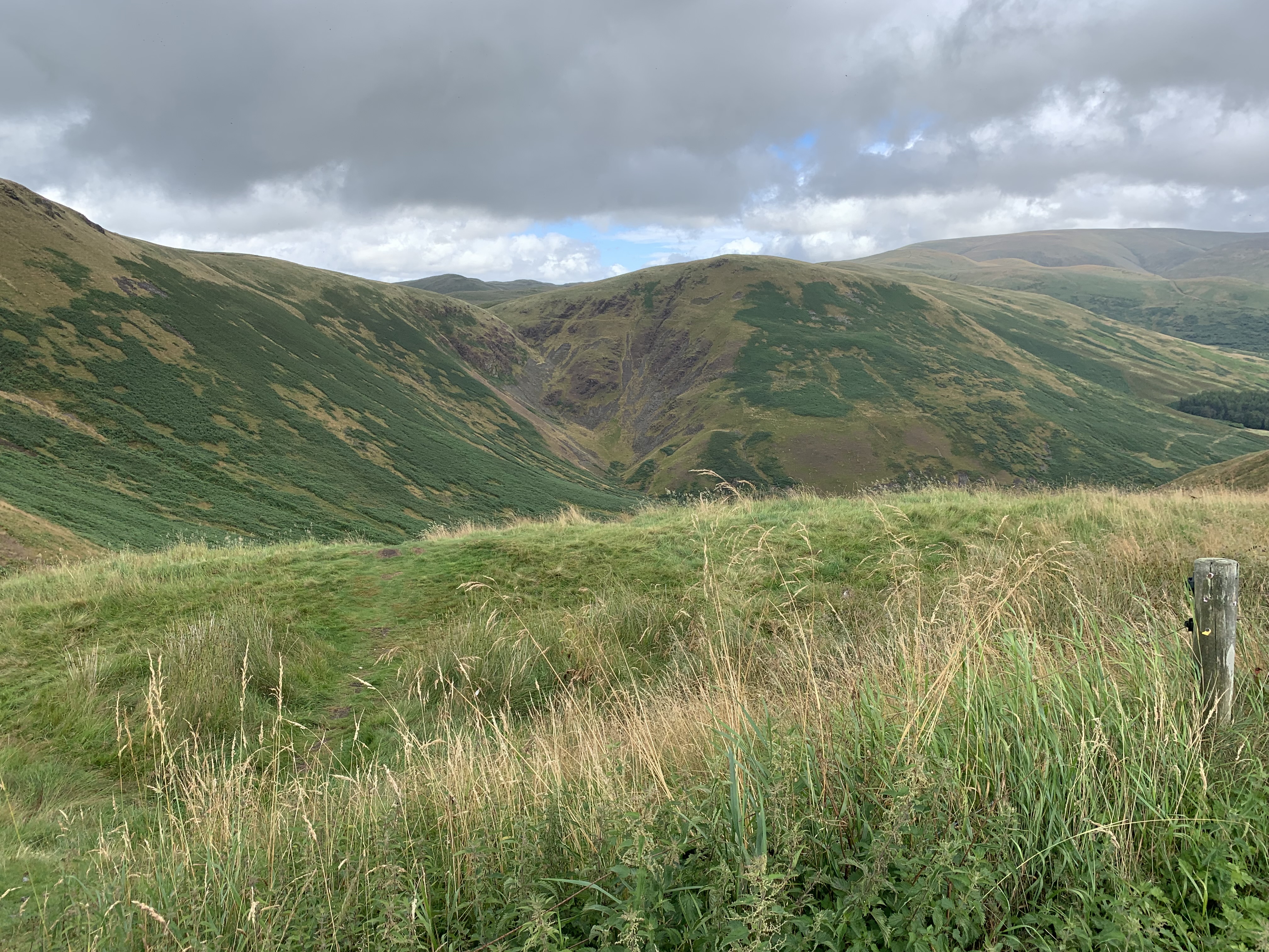
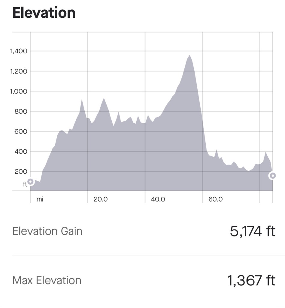
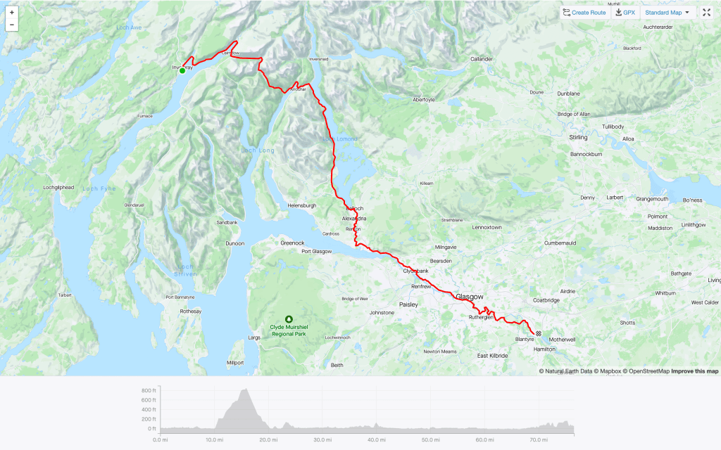
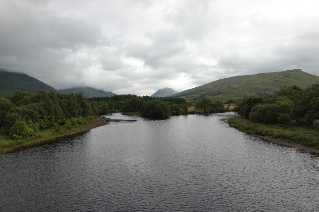
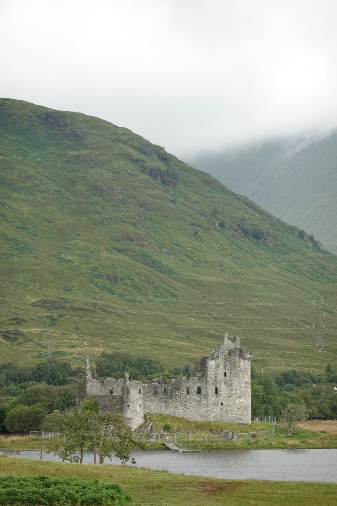
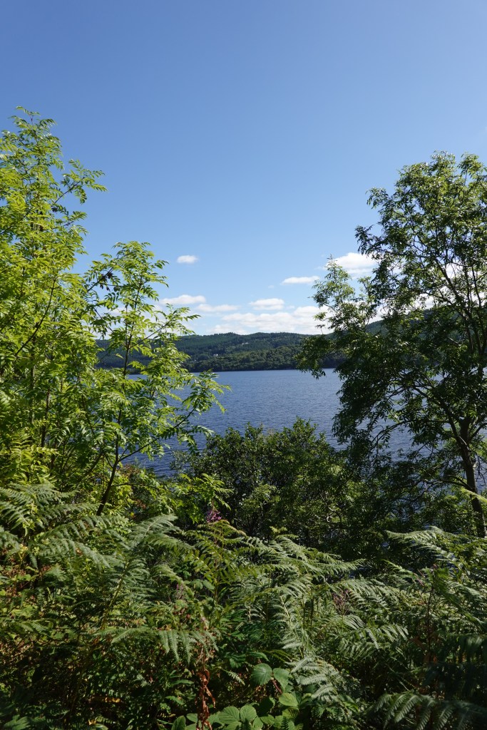
The Cornish crew passed us while we were having lunch, and we continued along the North Cornwall Coast and into our last major climb before Land’s End. (One climbs into Land’s End because thanks to a cliff it is 223 feet above sea level—see the profile below.) The coast was as beautiful as ever, and the weather was perfect.

North Cornwall Coast

With eight miles to go we met up with Rob in the van and with Denise, Donald, Mike and Sonjia. I replenished my water bottles, and we cycled together towards Land’s End. There were a few little climbs, but mostly this was a triumphal procession. As we approached the famous line in the road we were met by Denise’s family and friends, and by John and Jamie’s partners and family, and it was all quite emotional. The photos below sum up how we all felt.

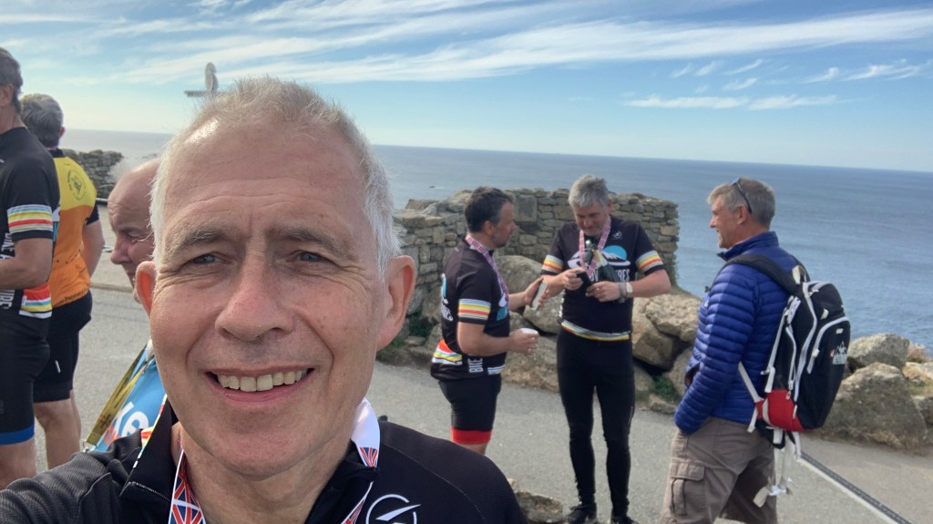
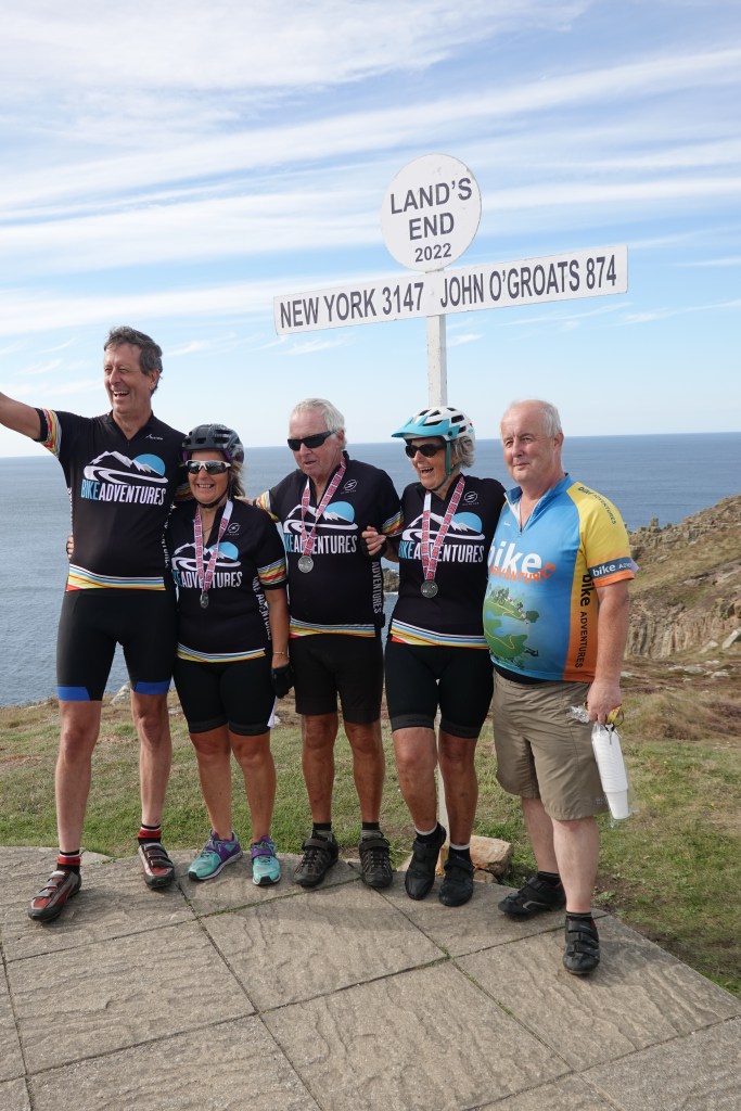
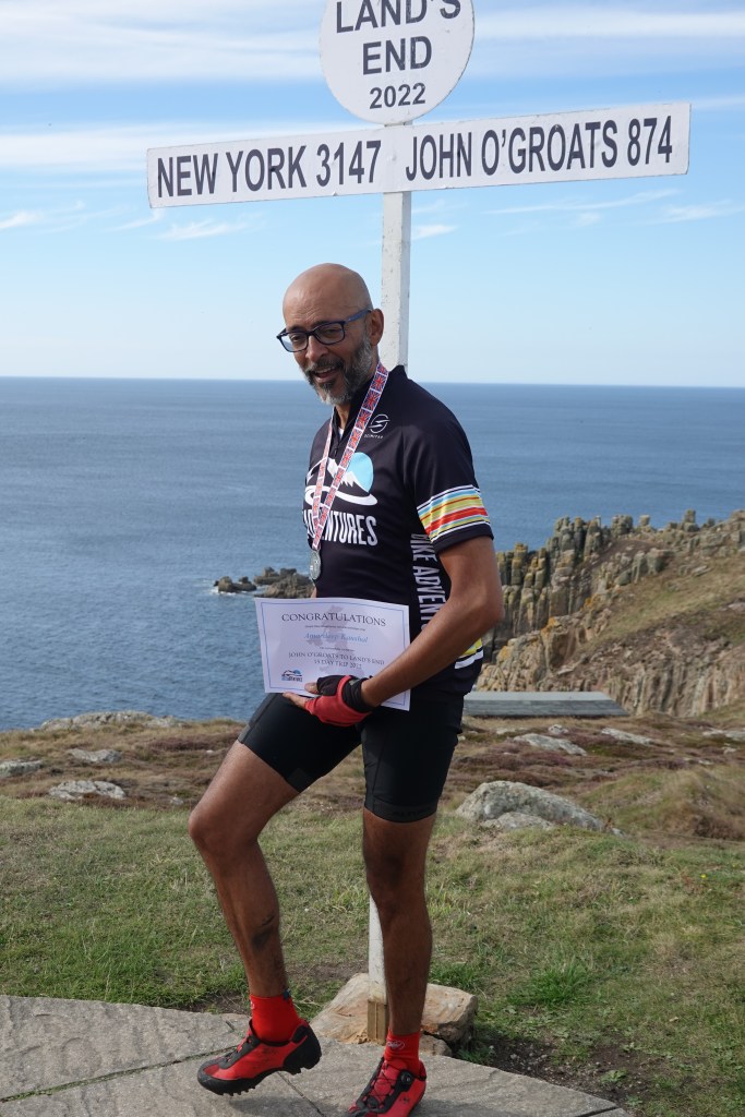
Rob gave us all a glass of fizzy wine, a certificate and a medal (Jamie is wearing his in the photo above) and eventually we dispersed. The Cornish contingent went home, while others, including me, went to a hotel in Penzance, where our bikes either went into our rooms or into the van eventually to be delivered to our homes.

That’s what I call a wine glass

Dinner that night was bittersweet. We were relieved to have finished, but it had been fun, and it would be strange not to be cycling the following morning! I ordered a bottle of red, and received with it the biggest wine glasses I have ever seen. I was reminded of Theresa Marteau’s work. To quote the Cambridge University web site, “when restaurants served wine in 370ml rather than 300ml glasses they sold more wine, and tended to sell less when they used 250ml glasses.” I should have asked them whether they had heard about Theresa’s work.

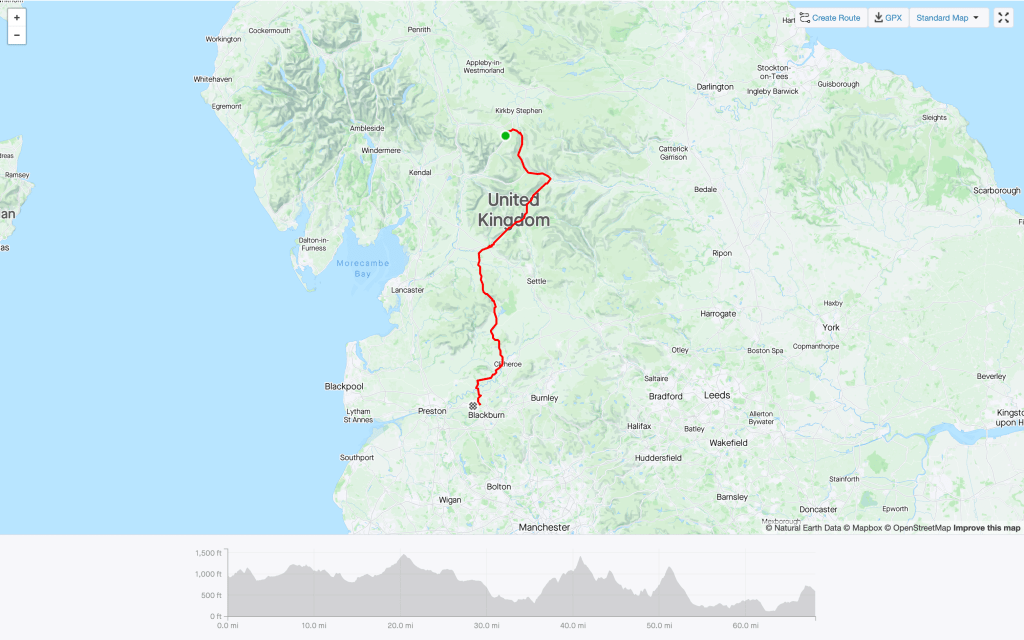
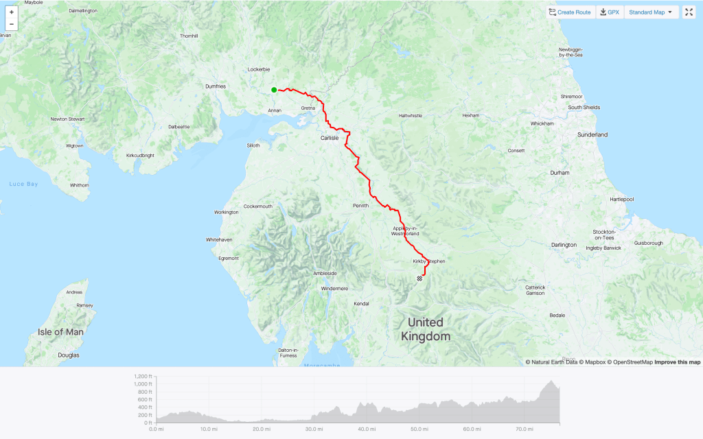
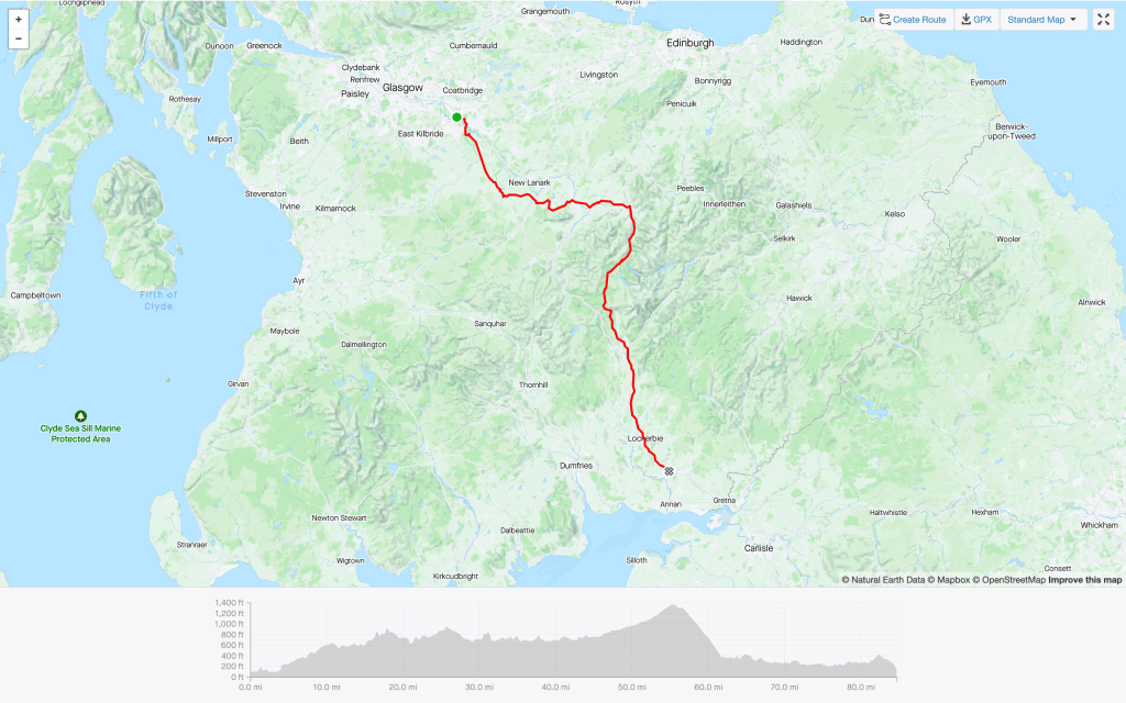
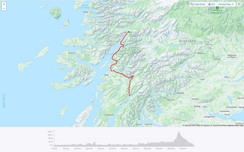
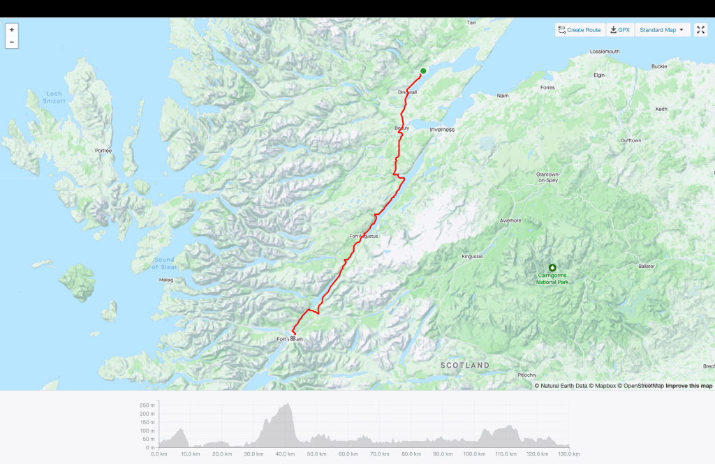
And then to bed. Today’s route is below, and you can see nicely how well we followed the North Cornish Coast. It was a great end to a great ride.

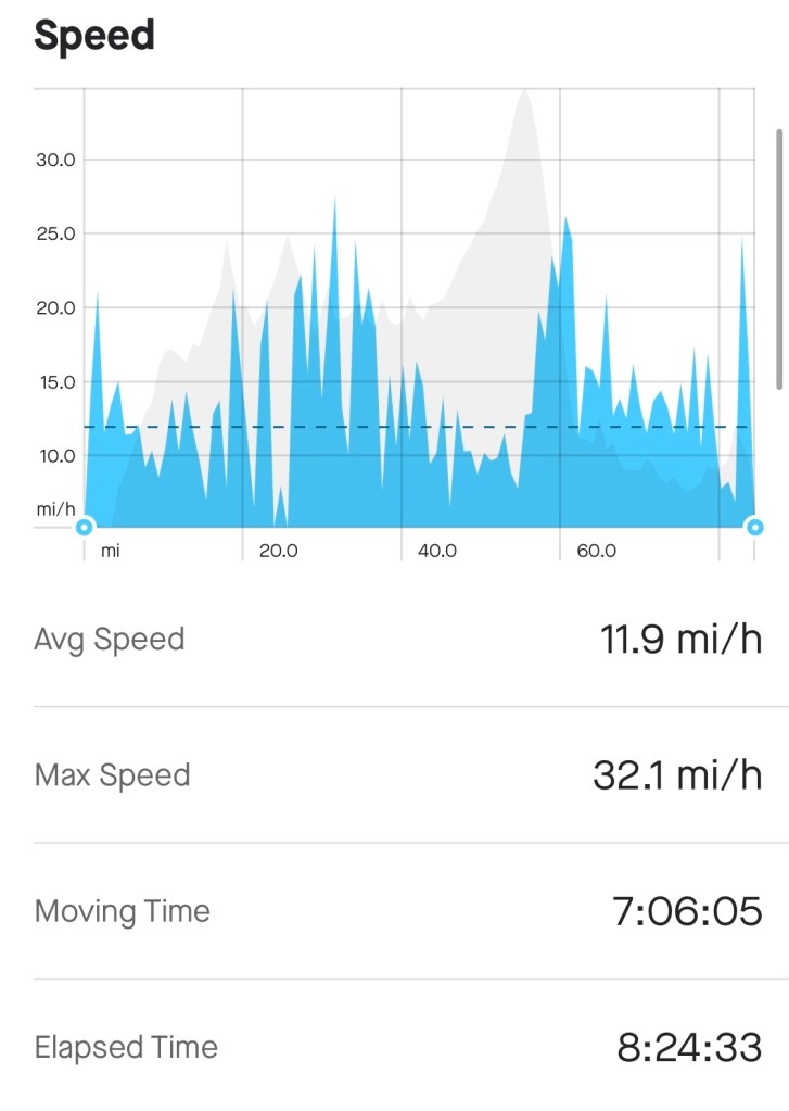
We cycled 69 miles today, climbed 5,764 feet, and took five hours 35 minutes to do so. My weighted average power was 124 Watts, my average speed 12.3 mph, and my maximum speed 32 mph. I used 1,826 calories. The total distance from JOG to LE was 1050 miles.

And here is my favourite photo, of the whole team around the famous sign.

Day 10—Acton Bridge to Wentnor

This is a day late, so I apologise to any reader to whom I provide their early-morning entertainment. (Hello JH!)

The funny thing about cycling, or any long-distance sport, is that the energy one has to do a challenge is always three miles less than one needs, irrespective of the length of the ride. It sounds bizarre, I know, but a couple of other people said the same to me at breakfast this morning, so it may be true. It’s all in the head of course, as are many sporting endeavours.

And the funny thing about blogging is that there are always things I keep forgetting. Yesterday, for example, while passing through Blackburn, I was hoping to see lots of holes in the road, so I could refer to the Beatles song A Day in the Life (look it up). I was sure I’d see lots of holes on a road called Broken Stone Road, in which there was a warning of loose gravel (below), but to my disappointment the road was almost pristine. Maybe, 55 years after Sgt Pepper was released, Blackburn has got around to fixing the holes.

But what of today? This was an intermediate ride, somewhere between yesterday’s recovery ride of 53 miles and tomorrow’s ride of 85 miles. To tell you the truth it was one of the least memorable legs so far for some reason. It was flat for the most part, and the scenery was not the most inspiring we had seen, although a castle apparently hewn into the rock was interesting.

We stopped for coffee at a café in Malpas, where we had also stopped four years ago when I did LEJOG. As usual I was in a middle group of one, with the leading group of Amardeep, Carl, Jamie, John and Les arriving at the café 20 minutes before me (or maybe a bit more!) and the trailing group of Denise, Don, Mike and Sonjia (usually accompanied by Andy) arriving 20 minutes after me. I had been wondering about the etymology of Malpas, and it’s as obvious as can be: it’s from the old French and means “bad or difficult passage”.

Because it was less scenically interesting, I thought I’d make a couple of videos (lots of people seem to make videos these days). I must admit that they would have been better with a mouth-mounted GoPro, but maybe that’s for another day.

First video—it’s 67 miles, not 73
Cycling downhill
Cycling uphill

This was a day when we didn’t have a real lunch stop, so I popped into a small supermarket (I can’t remember which one) and, greatly daring, bought a Ginsters pasty (I had been warned off this by many people!). Actually, it wasn’t too bad, and with some grapes and Lucozade it got me to the foot of the hill before the B&B where most of us were staying. It was a steep hill, going up to 18%, and I must admit that I had to get off a couple of times. But I got there, and rather than spend the night there I was quickly whisked off to a B&B six miles away, where I stayed with Rob and Andy. We had a really good dinner and I returned to my room with its poor wifi and went straight to sleep without writing this blog.

Statistics!

We cycled 67.1 miles and climbed 3,783 feet, with an average speed of 11.9 mph. I used 1,707 calories.

Day 9—Mellor to Acton Bridge

Today felt like a rest day in the Tour de France. You still cycle, but it’s really an easy day where the main thing is to turn your legs over and (in our case) try not to arrive too early at the accommodation. Rob explained this to us in our briefing today, and indeed the tone was set by having a later-than-usual breakfast (08:00) and by having the time to clean our bikes a bit and to take a little more care about pumping the tyres up and so on. Indeed, Carl had time to leg it over to Halfords (his wife was visiting, and she had a car) to buy a new Garmin. His old one had finally packed up.

So we set off quite late, and as you can see from the map at the end, after some lumpiness at the beginning the rest of the day was quite flat, except for the very end of the ride, when we approached Acton Bridge. As I was cycling along it struck me how many churches I had passed, and I decided to take pictures of as many as I could (without becoming obsessional about it). As you can see below, there were quite a few. And as I have said in a previous blog, if you were a historian whose specialist subject is (say) church architecture and how it differs as you go from north to south in the UK, then a three-week Bike Adventures JOGLE or LEJOG would be the way to do it.

Coffee was at just 16.8 miles, at the Rivington Village Green Tea Room. I have been there before, and very good it is. I had a sort of curranty slice, which was very nice, and a cup of coffee, before setting off again fairly slowly. As we ate, John heard that his fund-raising efforts for the HoneyPot Children’s Charity were to be publicised with an interview that evening, which is fantastic news. As I type, he and Jamie (his son) have already raised £72,200. Amazing!

And I should mention that Les and Carl are raising money in memory of their friends Dickie and Baxi, and that Denise is supporting Cancer Research UK (I don’t have the link to hand, but will find it). Good luck to them all.

We had arranged to have lunch at a place just after Bents Garden Centre, near Glazebury (31.7 miles). The route there from the Village Green Tea Room was slightly lumpy, and there was a short hill around the 20-mile mark where I fell into conversation with a gentleman who was riding a brand-new blue Pinarello Dogma F. This is one of the bikes to end all bikes. It was released last year, and the man, who works at (or owns) a bicycle shop in Ormskirk, explained carefully that he bought it at last year’s price. This means it must have cost about £12k. I was pleased that he was puffing almost as much as I was going up the hill, so I don’t yet feel the need to invest in such a machine myself!

The Pinarello is immediately behind Rob’s head

The guy stopped with me at the top of the hill where Rob had parked the van, but after discussing his machine with other members of the group he disappeared.

On we went down the hill for lunch, at the excellent Halls Victorian Sweetshop and Tea Room. I was feeling a bit gastrically challenged, so didn’t have anything to eat, and indeed as I write, at 21:49, I still feel a bit ropey. I hope I’m alright tomorrow!

Anyway, the rest of the ride was pretty uneventful. I went slowly enough that I arrived at a respectable 4:30 pm, and it was nice to ride slowly enough to look around me properly. That poem by William Henry Davies, of which everyone knows the first two lines, occurred to me:

What is this life if, full of care,
We have no time to stand and stare.

I had never, until now, read the whole of the poem and (speaking as a scientist and not a poet) I must say that there is something of the schoolboy about it, with its repetition and its relentless iambic tetramers. Oh well—I expect I am in a minority (maybe of one). Reading about Davies has at least inspired me to read his autobiography, Diary of a Super-tramp, which looks pretty interesting, even if it did inspire the name of the eponymous prog-rock turned pop music combo (think The Logical Song and Dreamer).

Moving on! Eventually, after a short climb, I arrived at the Wall Hill Farm Guest House and went to my room. Rob had already kindly put my bags inside. We were to have dinner in a nearby restaurant, but it was closed (Covid) and the gang went off instead to the Hanging Gate while I nursed my stomach. Better tomorrow I hope!

Here are my stats:

Today’s route

We travelled just 53.1 miles, and ascended 2,946 feet, so this was a feeble effort compared with yesterday. My weighted average power was 111 Watts, my average speed was 12.3 mph, and my maximum speed was 35.0 mph. And I only used 1,409 calories today. It’s tougher tomorrow, so I hope I have a good breakfast!

Day 8—Ravenstonedale to Mellor

The gang met as usual at breakfast today, and Rob gave his introduction to the day’s ride, with warnings of road conditions, ideas of where to eat, sights we might wish to see, and any nuances of the route. There was a sense of foreboding: Andy had described this as the ‘Queen stage’, Rob as the hardest of all the stages we were to do, and I remembered that it was pretty tough in the other direction four years ago. And it was harder than four years ago, because it was ten miles longer: the usual hotel in Clitheroe wasn’t available, so we were to go further, to Mellor. In retrospect I thought Rob and I could have been a little more upbeat, channeling our inner Henry V at Agincourt: there was a lot of climbing, true, but we were cycling through some beautiful country, and those of us who outlived this day would certainly stand a tip-toe whenever JOGLE was discussed. But in the end we all had stomach for the fight, and off we went.

I left first, to maximise my chances of arriving before 5:00. I was surprised that no one caught me for a while, so I took a few photos along the way. It was pretty desolate, but quite beautiful. At this point it was what we cyclists call ‘lumpy’, but there were no really scary climbs.

As I went on, the ride entered North Yorkshire, as a sign made very clear (there was no such climb indicating that we had left Yorkshire, I must say). Around this time I was caught by Amardeep, Carl, Les, Jamie and James, but I managed briefly to get ahead of them and take photos of them climbing a 15% slope. I was interested to see their pain faces, but they seemed remarkably unaffected! Here are John in orange and Les in yellow.

At this point the weather was overcast but pretty dry, and we continued to ride over open moorland. The weather remained OK, and I was beginning to think about having some coffee. I bumped into Rob, who had parked the van by the side of the road, and we agreed that Ingleton was a good bet. Ingleton is an attractive village, and there is a slightly complicated story about the place that involves Arthur Conan Doyle. I like stories involving Conan Doyle—my earlier LEJOG blog mentioned the village of Musgrave (which we passed yesterday) and how the Sherlock Holmes story The Musgrave Ritual influenced TS Eliot when he wrote Murder in the Cathedral. In this vein I might add that Eliot’s description of Macavity the Mystery Cat was based on Conan Doyle’s Professor Moriarty. The second line of the poem reads “For he’s the master criminal who can defy the law” and the last two lines read “Are nothing more than agents for the Cat who all the time/Just controls their operations: the Napoleon of Crime!” As Eliot himself said, Good writers borrow, great writers steal.

Anyway, Conan Doyle’s mother lived in nearby Masongill, and when visiting her he would have arrived at Ingleton railway station. His subsequent journey by cart would have passed through Holme Head. When Conan Doyle wrote A Study in Scarlet he was going to name his principal character Sherrinford Holmes. That same year, however, the church of St Mary the Virgin in Ingleton was rebuilt to the design of famous Liverpudlian architect Cornelius Sherlock. Coincidence? I think not.

Yet another view

I found a coffee place in Ingleton, using my four-year-old local knowledge, and met Amardeep, Carl, Les, Jamie and James. I had a big cheese scone and a cup of coffee, and after chats about the relative merits of Garmin and Wahoo cycle computers (Wahoo for me) I set off, a few minutes after my chums. By now it was quite hot, and I had taken off my arm warmers. This may have been a mistake. At first all was well. The scenery was as impressive as ever, and the physical features of the land reminded me of many a geography lesson with Mr Elliot. I only wish I could remember the names of some of those features.

Geography lesson

But then it was the first really tough climb of the day, at about 34 miles. You can see it on the route profile at the end of this blog. Clucking bell. It was over five miles long, and I had to stop a few times, when the gradient got to about 15%. I didn’t take any pictures during the ride, but I think the image below is taken from the end of the ascent, looking down. It gives no impression whatsoever of how tough it was.

From the topi of the climb, I think

And then it stared to rain hard. My camera stopped working, and I couldn’t be bothered to reach into my back pocket for my phone, so from this point on, no pictures. Let me summarise the next 25-odd miles by saying that the downhills were treacherous and the two remaining climbs exhausting, each occasionally getting up to 18%. I mean, I wouldn’t have wanted to have been anywhere else, but it was really hard. The last climb, fortunately, brought us into Mellor, and Rob was waiting to put our bikes under a tarpaulin before loading them into the van for the night. I’m hoping that it’ll be dry-ish on Tuesday morning, so that I can clean off the mud and just make the bike a little more presentable.

Amardeep, Carl, Les, Jamie and James had already arrived at the hotel when I arrived at about 4:30, but Andy was still on the way, having had a gear cable replaced, and other members of the gang didn’t arrive until 6:30. That’s a long, wet, exhausting day on a bike, and real credit to Sonjia, particularly, for doing so well.

The main thing with respect to stats is that I increased my Eddington number to 51, which I am very excited about. I am now in the top 44% of cyclists, which at least is the top half! Otherwise, here is the route:

Our route and the profile

Our distance was only 68.1 miles, which is small beer by previous standards, but we ascended 7,064 feet, which is quite a long way. Imagine climbing a 1.3 mile-long ladder, carrying a bicycle on your back. I used 2236 calories, the most yet, so I felt justified in having a big supper!

Day 7—Ecclefechan to Ravenstonedale

The inscription on the bridge

Today was a big day. Perhaps most importantly, it didn’t rain at all. This was fantastic, and I am even showing faint signs of a cyclists’ tan. But in addition, we left Scotland and entered England. To mark this achievement we set off together to the bridge over the River Sark that marks the border between the two countries. There is an inscription half-way across the bridge that Rob read out to me, but to be honest I couldn’t make out much at all (see the photo above). I originally thought the inscription was taken from the Burns poem Such A Parcel Of Rogues In A Nation, but Rob tells me it’s completely different, and refers to the name of the structure, which is the Corries Mill Bridge, now a category C listed building. Oh well.

We had cycled the 11 miles from our Ecclefechan hotels to the bridge together, a bit like the neutralised start in the stages of the Tour de France, but as soon as we had taken our photographs, and listened to Andy’s recordings of Three Lions, Jerusalem, and Elgar’s Pomp and Circumstance March No. 1 (this was only slightly naff), we headed off at our own speeds. (Although not before John and Jamie changed their shirts to publicise their efforts for the Honeypot Children’s Charity.)

The first part of the day was pretty uneventful. At one point we cycled along the narrow path that I cycled along in 2018 and fell off. I was pleased not to do so today.

The great thing on these rides is to decide where to have coffee and lunch. As I have said before, I am a fan of having coffee at well over 33% of the ride, and then lunch at about 66%. This means that the distance to be covered after lunch is easily manageable, and makes sure we get to the next hotel around 5:00 pm. So we had coffee at 28.8 miles (38%) at a pub with the unlikely name of Fantails. The meal was slightly unusual because the pub served only coffee, and we had to get our carbohydrates at the nearby village shop. I had a bar of chocolate; I have been missing chocolate!

As the day wore on things became hillier and hillier. I was OK until lunchtime, at 1:30 and 46-odd miles, when a sausage roll, a pear, and a kind of energy bar thing were a great help. I had the sense that the remaining 30 miles would be manageable. But it was tough going, and especially the last 15 miles, which were inexorably skywards. But I eventually managed the last 100 feet of elevation and rolled into the Fat Lamb.

It turned out that the Fat Lamb isn’t putting the heating on, so I put my washed wet clothes into the hotel’s drying room. When I came back after dinner they were nearly dry, so I’ll give them another 30 minutes.

Maybe tomorrow I can be more inspired! But for now here are my stats.

The route

We cycled 76.7 miles, and climbed 4,744 feet. My weighted average power was 109 Watts, my average speed was 12.3 mph, and I used 1980 calories.

Day 6—Motherwell to Ecclefechan

Second blog in a day, in an effort to catch up and thereby make subsequent entries less rushed.

It rained much of today. I know this statement is otiose (hello Ed!), but it’s so irritating that I thought I’d mention it again. We were aware that we had a long ride to Ecclefechan today, so we had an early breakfast (after I had helped Carl load some .gpx files to his Garmin) and got out as fast as we could, about 08:15.

So off we went through the Strathclyde Country Park, negotiated the M74, and we were on the open road. Everyone says that it’s much more sensible to do LEJOG than JOGLE because of the prevailing winds. They are right. As well as rain today we had a really horrible headwind to negotiate. And I also had a minor brake malfunction when something or other got stuck in the front disc assembly. It seemed to have bent the disc a bit, which is bad news, but I took the wheel out and forced the pads apart so that they’d have to re-set their position, and everything seemed OK.

I need to record that at about 25 miles the wind died down, the road was smooth, the rain eased off a bit, and there was a slight downhill gradient. Brilliant!

We had discussed whether to stop for coffee in Biggar (London’s big, but Biggar’s Biggar etc etc) at 33.6 miles or in Broughton at 38.8. I went for the latter, on the principle that the more of the ride you do before coffee or lunch, the less there is to do afterwards, but alas, I found myself alone in the excellent Laurel Bank café. At this point, the sun came out and suddenly the weather was fantastic, and this inspired me, on the next stage of the ride, to take the photographs below (I can’t summon the energy to take pictures when it’s pouring).

After Broughton was a long slow climb that leads towards Moffat (look at the stats below). On the way, near the top of the climb and before the descent into Moffat, I passed a hollow called the Devil’s Beeftub (the bottom image of the four above). The ride that is known as the Devil’s Beeftub starts at Moffat and ends at the Beeftub, and is rated 4/10 by cycling cognoscenti. All I can say is the descent, in the other direction, is brilliant. Such fun!

Moffat was our agreed lunch stop, but I couldn’t see anyone around so I had a quick Scotch Pie and went as fast as I could for the remaining 20 miles to Ecclefechan. It was, of course, still raining, and the road was pretty rough, so it was pretty tiring. I checked into my room as quickly as I could, had a shower, and joined Les and Carl, and then Jamie and John, for dinner. Here we are (from left to right it’s Carl, Jamie, Les, Jim and John).

Dinner (all a bit tired)

A shorter day tomorrow, but with the same amount of climbing. We shall see how it feels! Here is a map and some stats for today:

Today’s progress
Data

Speed and energy consumption are on the right (over seven hours cycling and only 2,397 calories!) and more data about heart rate, elevation. and speed are below. I’m surprised my heart rate went up as high as it did during the climb (I haven’t been above 180 for a long time) but it came down very quickly so I’m sure it’s OK! More tomorrow…

Day 5—Inveraray to Motherwell

Let me begin by thanking Pen Rashbass, who identified the castle in the last blog as Kilchurn Castle, on Loch Awe. I hope that my realising that people are actually reading this stuff will inspire me to up my game a bit.

Not such a long ride today (much longer tomorrow!) but this was a tough one because of the drag of getting through Glasgow. There were lots of twists and turns and it seemed for a while as if the conurbation would never end.

To begin at the beginning, Carl, Les and I had stayed in our own guest house in Inveraray, and the first thing we did was to roll down to the George Hotel (past the town jail—rather like a wild west movie) to meet everyone and to hear Rob’s instructions for the day. His advice was as pithy and informative as ever, and, as ever, I found myself remembering not a word. This doesn’t usually matter, luckily. As long as one’s cycle computer has sufficient resolution it’s simply a matter of following the bread crumbs.

Nessie taking a break in Loch Fyne (you have to look hard, near the bottom of the photo)

We set off with Carl, Les, Amardeep, Jamie and John leading the way. We passed over a bridge controlled by traffic lights, and as I waited I was astonished to see that Nessie had decided to take a short break in Loch Fyne! No wonder we didn’t see her/him in Loch Ness itself.

Inevitably it was raining. I am reminded of John Self in Martin Amis’s Money: “Unless I specifically inform you otherwise,” Self says, “I’m always smoking another cigarette.” Just substitute “it’s raining” in the second half of the sentence, and you’ll have a pretty accurate idea of what life is like on the ride so far.

We rounded Loch Fyne and the eponymous Oyster Bar HQ and headed for the Climb of the Day. I had been waiting for this, because it was such a fun climb when I did LEJOG in 2018. This was from the other direction, of course, and it is in this other direction that it features in various “best 100 cycling climbs in the UK” lists. Irrespective of direction, however, the climb is called “Rest and be Thankful”, so named because the soldiers who built the military road inscribed these words on a stone in 1753. The climb resonates with my LEJOG friends of 2018 (when it also rained, hard), and for them, here is a view from the top. Pretty spectacular.

Jim at the top of Rest and be Thankful

I went down the other side of the hill with Andy. We couldn’t go terribly fast because of all the traffic, but it was good fun, and it took us to the banks of Loch Lomond. It was great to cycle along a path, but it was less good that it was still raining (obvs) and that the path was not in great shape. Denise went down, and two others came a cropper later today. Our worst injury day so far.

(I might add that Rob has a huge store of stories of trips like ours, some of injuries and other ailments, but also some that are fruity to say the least. We might write a book together. “Confessions of a Bicycle Tour Guide Leader” sounds a bit tame, but boy, it would make good reading!)

The rest of the day involved heading for Glasgow, and passing through it along the banks of the Clyde. A measure of the complexity of these manoeuvres is that this segment of JOGLE requires 10 Bike Adventures route sheets (usually three or four suffice). The weather was still pretty unpleasant, so I didn’t take many photos, but here are some examples.

There was a dovecot (or a doocot, as they call them around here), an angler, a rainbow and a bridge, and as I passed the last of these I got close to our destination—the Holiday Inn Express in the Strathclyde Country Park. We left our bikes in the manager’s office and toddled off the the Toby Carvery for dinner (and the least said of this the better!) The rooms were equipped with an electric heater of unusual power, and this made short work of drying our clothes.

Finally, stats:

I did 76 miles in 6 hours and 23 minutes moving time. Climbing was 2,753 feet, and I used 1,835 calories.

Until tomorrow!

Day 4—Fort William to Inveraray

I am running with a 24 hour delay on my posts at the moment! I hope I catch up soon.

Today was defined by rain. It rained as we left the Distillery Guest House, and it rained for most of the first half of the ride. I was one of the first to set off, and this meant that I was able to take photos of members of the group as they overtook me. Here are John, Les and Carl (moving so fast that the pictures are rather blurred).

As always I took a photo of the landscape to justify the fact that I had stopped. This is Loch Linnhe.

View of Loch Linnhe
Abandoned platform

The weather was bad enough that I didn’t take enough notice of my surroundings, so, unforgivably, I missed Castle Stalker. I did see it on my LEJOG trip, and there are some photos there, but it was irritating that I didn’t see it this time. What I did see was the abandoned station near the castle, a station that was closed in the Beeching cuts. Here is the old platform.

We had our first break at the Creagan Inn, which I have visited on previous visits to Scotland. It was still raining hard, and we sat on our jackets so that we wouldn’t soak the chairs in the café. John kindly bought me a coffee and a cheese scone, and I took the opportunity to put my arm-warmers on—it was cold as well as wet. The view from the Inn over the loch was as spectacular as ever (see below).

The view from the Creagan Inn

It was still raining when we left the Creagan Inn, but it eased off during the rest of the ride. As usual I can’t remember exactly where I took different photos, but the first one below was before lunch, I think, and the second after lunch. If anyone knows the name of the castle, I’d be pleased to hear it!

Lunch was at about 53 miles, at the Cruachan Power Station visitor centre. It was good. I had a very filling leek and potato soup, and this set me up for the rest of the ride, which included quite a climb before heading down into Inveraray (see below). Les, Carl and I were in a different guest house from the others, but we joined everyone for dinner at the George Hotel. I was so tired when we finished that I failed to write this blog, so I hope, 24 hours later, that I have remembered everything of note!

Here is the route, and I’ll put a few stats afterwards.

We covered 120 km in five hours 51 minutes moving time, and climbed 1002 metres (I’m going to juggle between units, I’m afraid, but I’m sure any reader can do the conversions). My weighted average power was 108 Watts today and I used a feeble 1,835 calories. The images below show the elevation at different points in the ride and my heart rate.

More tomorrow!

Day 3—Evanton to Fort William

I’m a day late writing this, because I was tired by the time we got to Fort William and because we didn’t have anywhere set up for dinner, so some exploring was required. And Fort William, for all its many virtues and its proximity to the Highlands and all that stuff, is not well served for restaurants. But I did manage to find somewhere eventually, and it was fun to eat with Denise, Donald and Sonjia, who I hadn’t spoken much to before that. (I am writing this in a hurry, so grammar is going out of the window, I’m afraid.)

Carl taking a photo of Les

Anyway, we set off at the start of the day from Evanton’s Novar Arms Hotel at about 08:45, but not before Les recorded a message to his many fans and was photographed by Carl. It was not too cold, but we all wore rain jackets because the weather has been so changeable. You’ll see in photos later that it really warmed up as the day went on.

It was scheduled to be our longest day yet: 81 miles and over 4000 feet of climbing. We set off through Dingwell heading for the Great Glen at Drumnadrochit, a town noted for its enthusiastic embracing of the Nessie myth. The route at this point was (as cyclists say) lumpy. There was a long steep climb followed by a shorter very steep descent. The climb revealed how green fields are in Scotland. Quite a difference from the south of England. The descent was fantastic. I had climbed it four years ago from the other direction (stopping just once, I think), and I can’t believe I actually managed to do that. Going down was fun, and if there hadn’t been an over-cautious car in front of me I would have got to 40 mph easily.

Green fields

Drumnadrochit, at about 27 miles, was where we stopped for coffee. I am beginning to like the rhythm we are setting up: a good chunk out of the ride before coffee, get well over half-way before the lunch stop, and then blast on to our destination. This was a good chance to catch up with everyone, and in my case to ask Rob to take my waterproof jacket and swap it for my packable rainproof Gore jacket. It was now pretty hot, and all I was wearing was a ‘base layer’ and a short-sleeved cycle shirt.

The route now followed that of the Etape Loch Ness, passing the remains of Urquhart castle and heading towards Fort Augustus. I took a few photographs along the way, and I’m showing them all here because if any reader happens to be looking at that view in real life and sees a pair of sunglasses—they’re mine. I put them down when taking a picture and forgot them. Bother!

We stopped at Fort Augustus for lunch. I phoned ahead to Fort Williams’s bike shop to ask when they closed, to see if I could buy a new pair of sunglasses, but they said they didn’t sell them. I was surprised, because expensive sunglasses are de rigueur among fashionable cyclists, but on reflection I suppose the sun shines but rarely in Scotland. I also made an appointment with my optician to get a new pair of regular glasses as well as shades—it seems to have been a long time since I have been to the optician.

I had a quick lunch and headed off along the Caledonian Canal before reaching Neptune’s staircase (the flight of sea locks that takes ships onto the canal) and then Fort William. As I cycled I passed a French (as it turned out) family who reminded me of a famous photograph. Does any reader recognise my feeble reproduction? (I did ask the family’s permission to take the picture.)

I want to discuss cycling equipment at some point, and the question of whether one should do LEJOG/JOGLE in 15 days (as I am doing) or 9 days (as Julian Hutchings did). But for now I’ll stop with my stats and go out for some food. I’ll write today’s blog after that.

First, here is the route

Note the climb

And we cycled 130.15 km with a moving time of six and a quarter hours, climbing 1,224 metres. Average power was 122 W, and I used 2.449 calories, according to Strava’s algorithm.

More soon!

Day 2—Bettyhill to Evanton

I took to heart today the advice I received from Julian Hutchings: Eat before you’re hungry; drink before you’re thirsty; carry food even if (especially if) you think you don’t need it. I also vowed to cycle well within myself at the beginning of the day, and together these measures made for a great day. Rob tells us that it is his favourite leg of LEJOG, and I think he likes it in the opposite direction too. Maybe the only disadvantage of heading south rather than north is that one reaches the Crask Inn before lunchtime, although this does mean that their excellent selection of cakes is available…

But I am getting ahead of myself. The hotel in Bettyhill stands over a beautiful beach which, if it were on the south coast of England rather than the north coast of Scotland, would be packed. But it’s not, so it’s deserted. This was the view that met us as we set off this morning.

On leaving Bettyhill we turned south, and the landscape was breathtaking. We tonked along pretty quickly, with just a gentle climb, for about 25 miles. The first target was the Crask Inn at 32 miles, but before then we came across a private bridge across the River Naver, intended solely for the use of anglers, according to the sign. Many of us, however, padded our way across the muddy field nearby to look at the view from the bridge, which was impressive.

Soon after we set off I realised that I hadn’t taken many photos of my fellow cyclists, so as a first step I took one of Jamie Pocock (who gave me the video in Prologue 2) as he crested a hill. Jamie is one of the strongest cyclists among us (and the youngest).

I got to the Crask Inn at about noon, and following Julian’s advice I had a large slice of cake and a cup of coffee. By this point we had gained some altitude, but the gradient was so slight that we didn’t feel tired at all. It was then lunch at Lairg (carrot and parsley soup) and yet more beautiful scenery.

Scenery

Five miles on, and we arrived at the Falls of Shin, where, having made their way to the rivers of their birth, we could see salmon making their way upstream to spawn. It was quite a sight, and here is a movie of one of the fish battling its way up the falls.

Watch that salmon jump!

After the Falls of Shin it was a matter of girding the loins for the climb to the hills over Dornoch Firth. This was no joke (my Wahoo showed a maximum gradient of 12.4%), but we all managed well, and here is a photo of Rob bringing up the rear (he was Lantern Rouge today) and of Sonjia preceding him.

The views over Dornoch Firth were pretty spectacular, and they inspired us for the final run into Evanton, which I reached at 5:05. We checked in, and I showered and went through my usual post-ride rituals.

This was a good day for me as a cyclist. I am not a super-enthusiast, but on finishing today’s ride I found that my Eddington number had increased to 50. I discovered this from swinnynet, who explain that a cyclist’s Eddington number is E if she or he has undertaken E rides of at least E miles. The idea for the Eddington number came from cyclist and astrophysicist Arthur Eddington. It is not to be confused (and is unlikely to be!) with the other Eddington number, NEdd, which is the number of protons in the observable universe. Eddington originally calculated this as about 1.57×1079, but current estimates make it closer to 1080. Scientists of all persuasions will see similarities with the H-index, where H represents the number of papers you have published that have been cited at least H times. In this case H is Jorge Hirsch, an American physicist.

And finally, stats. Here is the route, and you can see the gentle climb during the first part of the day and the more challenging ascent later in the day.

We covered 123 km, climbed 994 metres, and I used 1898 calories. Average speed was 23.3 km/hr, I cycled for 5 hours 17 minutes, and my average power was 100 W. Perhaps one other piece of data: maximum speed was 60.6 km/hr (37.7 mph).

See you tomorrow!